Unley’s tree strategy is working. We have demonstrated that tree canopy can increase. Likewise, (and leading the way) that the loss of tree canopy can be reversed.
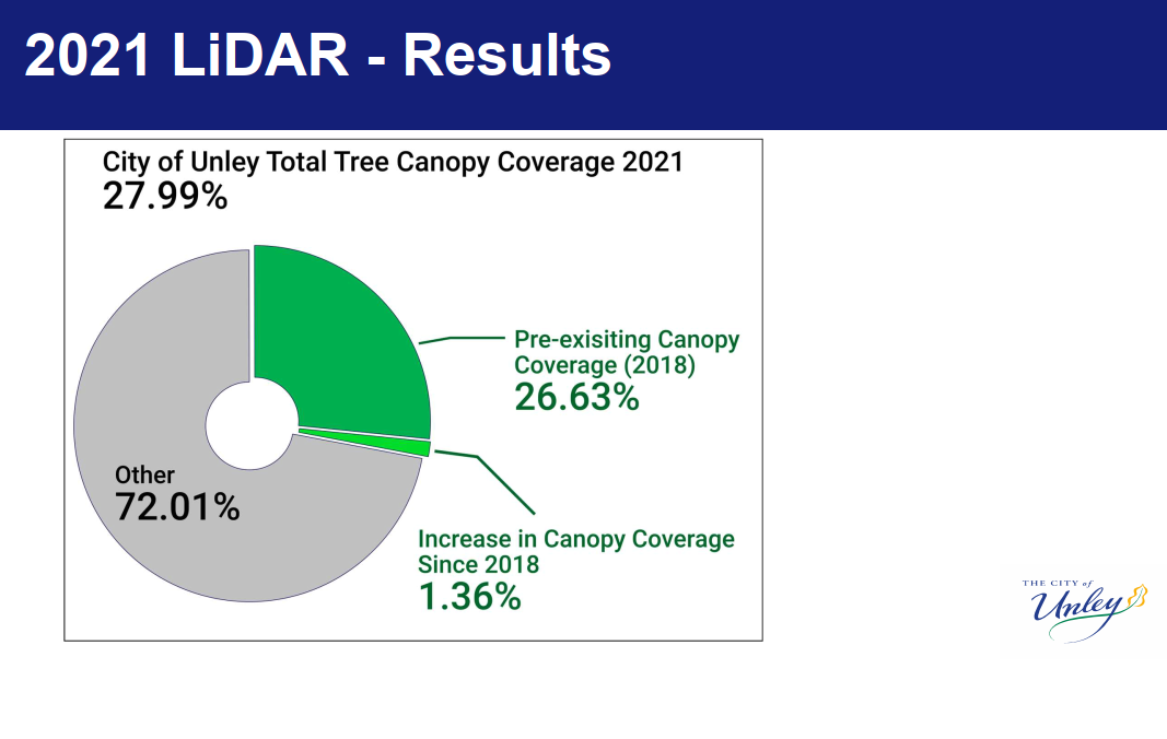 Council was briefed this week on the change in canopy cover over the last three years. The result is a resounding positive. Encouragingly we now have a total tree canopy coverage of 27.99%. Up 1.36%, this is a 5.1% improvement. Makes our target of 31% coverage look very achievable. These statistics are for trees 3.0m in height or greater.
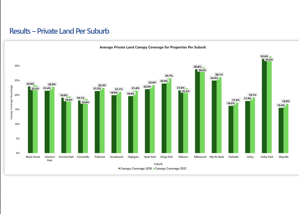
We have witnessed an increase in canopy cover not just on public land, but on private land too. Whilst it is a marginally increase, it reverses the trend of the previous ten years.
One of the keys to reversing the trend of declining canopy cover has been the use of technology. Technology to provide us with the data that provides a true picture of where we are at, rather than rely on anecdotal evidence. A picture that shows trends. It can also help us identify localised differences that can be addressed with specific actions.
Specifically, I am referring to LiDAR technology.
LiDAR stands for Light Detection and Ranging. That is short for a remote sensing method used to examine the surface of the Earth. It is a remote sensing method that uses light in the form of a pulsed laser to measure ranges (variable distances) to the Earth.
The use of LiDAR technology has provided us with pictorial evidence of which trees have grown. Likewise, those who have been pruned (and by how much) and those removed. It also shows us which trees have been added.
Information is available citywide. We can drill down to suburb by suburb, street by street and individual properties.
Data is king. This information will help guide future actions. It will identify where a focus may be needed so we can make informed decisions in the future.

Comments