It is absolutely necessary that we bring our own digital systems into the 21st Century. Only then can we aspire to the claim to be leaders in this space.
We should no longer be reluctant to move to a preference for digital communication in fear of missing those in our community still not using smart technology.
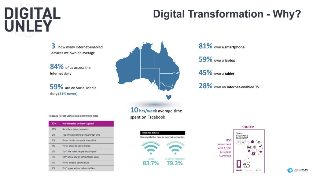
With those using smart technology being in the vast majority our primary communication focus cannot afford to be other than digital. 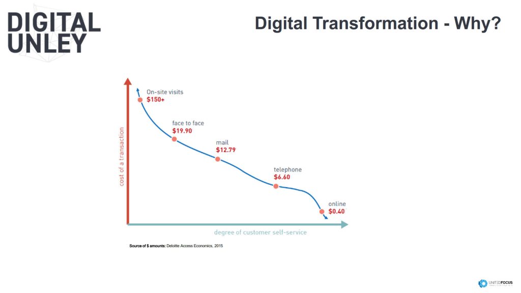
The cost per person to access those not yet using technology is far greater than reaching those who are. We must take advantage of this if we are to be efficient in our communications.
All staff should be able to operate “current” technology “on up to date” equipment. Windows 10 and Office 16 is essential.
My experience with the Surface Pro satisfies me that it is an ideal tool for elected members. I suspect staff as well. A portable computer, it can be used as a tablet. It avoids having to have a computer AND a tablet.
If using one machine only, it is preferable that we use a computer pretending to be a tablet rather than a tablet pretending to be a computer. Such provides those of us who prefer having only a computer or only a tablet to have their needs met.
Cloud technology is also a must.
The cloud allows everyone to access files they are authorised to access from anywhere. Not just physically at a Council facility. This includes the public.
Digitalisation allows us to make use of data (if and when collected) unlike ever before in history. That said, we must seek to understand and adopt the management of data. Incorporating this into our system going forward is a must.
We must be in readiness for the State Governments digitalising of the planning system. Developers (including mums and dads) should be able to lodge DA’s electronically. Rate payers under cat 2 notifications should be able to view proposals without physically having to come to the Civic Centre.
One area where much can be gained by a Digital approach is in processing Development Applications.
The smart use of data allows anyone who selects a particular site within the City of Unley to know immediately pertinent facts of that property.
This includes title information, the m2 of the allotment, the zoning, and automatically identifying such things as encumbrances and easements etc.
 The ability to identify immediately the amount of roofed area will be possible. Private open space likewise. It will automatically indicate 2nd storey opportunities whether in the roof space or not. It will not only also identify such things as permissible set-backs from front, side or rear set backs. We will be able to readily see such things as the required number of under cover carparks.
All at the touch of a button. No need now to understand the planning in order to navigate manually the printed development plan.
The challenge will be to know what data to keep and what data is of little or no value. This is something that must be appreciated now before systems are developed.
Mapping is another area that can make so much difference to helping us make informed decisions. From showing the impact of shadowing from potential new development to knowing what is happening to our tree canopy.
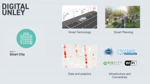 Car parking likewise. The use of sensors, data bases, cloud technology etc can provide us with opportunities to alert drivers as to where there may be available parks. It can also alert our rangers to those who have overstayed their welcome.
And so much more!
Comments