What Canopy Cover have you got? Do you have more than 15%? Or more than your suburb’s average? That is the question. To be or not to be.
Many of our ratepayers would be aware of Council’s aim to achieve a 31% canopy cover across the Council area. Many are also aware that to achieve this, we are keen to encourage all property owners to have at least 15% canopy cover on their own property.
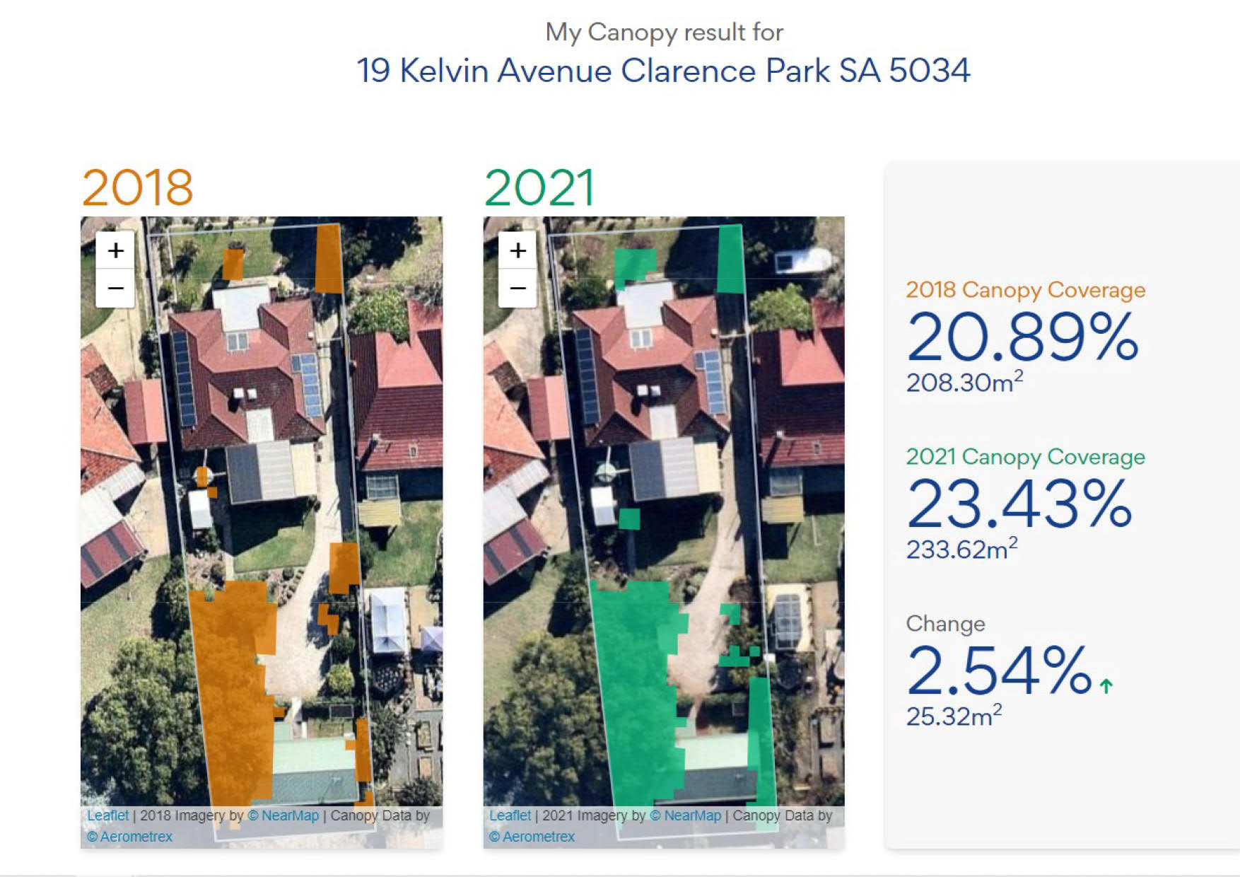
Again, many of our ratepayers would be aware that we have led the way by utilising LiDar radar technology to map our cover. Technology that calculates how much tree canopy we have. This can be calculated at a district level, or a suburban, street or property level.
I reported on this in a blog last August.
So, what canopy cover do you have? You can find out by using the My Canopy App.
Last year we provided ratepayers with how much canopy they have, via the use of this technology. We did this by way of a notation on their council rates notices, issued in July of last year.
We have now developed the technology further with an app that allows you to check for yourself. No need to find your old rates notice. Likewise, no need to wait for the next one.
You can now go on online and find out how much canopy cover you have. You will also find out how much additional coverage you may have achieved in the last few years. Or how much you have lost in that time.
I had a play with it over the weekend, checking many properties of interest to me. The graphic above is a screenshot of my own property. Pleasingly I have good cover, cover that exceeds the average in my suburb of Clarence Park. More than I thought I had.
I encourage you to download the app and check what canopy cover you have.
Don’t get me started Don.